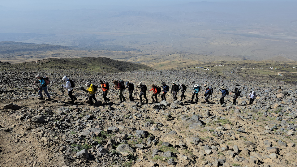
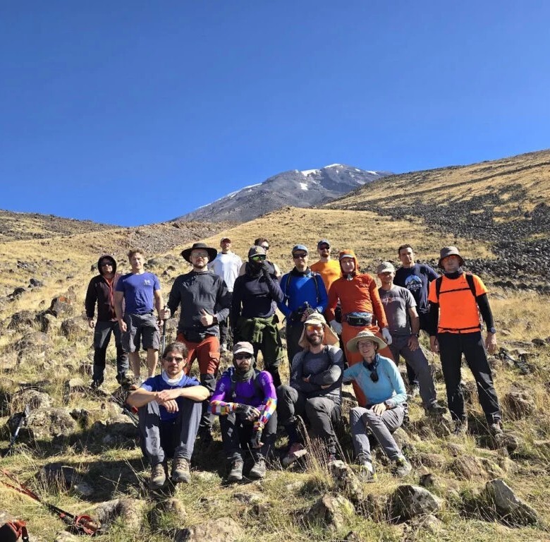
In September 2024, we brought 17 climbers to Mt Ararat. Fifteen reached the summit. One turned back with altitude sickness. One developed High Altitude Pulmonary Edema (HAPE) and required emergency evacuation and hospitalisation. This is that trip, day by day.
From the camp we could see the lights of Doğubayazıt all around us — showing how close we were to civilisation, and to the same extent, how far.
There are several airports within reach of Ararat — Iğdır and Ağrı are the closest. Our group flew from Antalya, which only had direct connections to Van, a historically fascinating city about two hours from Doğubayazıt. If you have time, arriving in Van a few days early is worth it — particularly for anyone interested in ancient history.
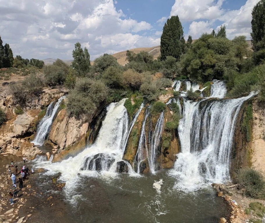
We didn't have that luxury. We drove straight from the airport, stopping at Lake Van — Turkey's largest lake — for a swim. The mineral content of the water makes it a genuinely strange experience to float in. Our second stop was Muradiye Şelalesi Falls, which turned out to be a crowded tourist trap in the middle of town. Fine for stretching your legs and getting an ice cream, nothing more.
One thing you can't miss while travelling this region: heavy military presence. Block posts, armoured vehicles on the roads. You feel that you're in Kurdish territory, close to the border.
We arrived in Doğubayazıt (1,650m) in the early afternoon and checked into Tehran Boutique Hotel — simple, clean, comfortable. The town itself doesn't cater to tourists, which is part of its appeal. There's a local market, plenty of tea houses and kebab shops, and a genuine friendliness from locals — don't be surprised if a stranger invites you for tea.
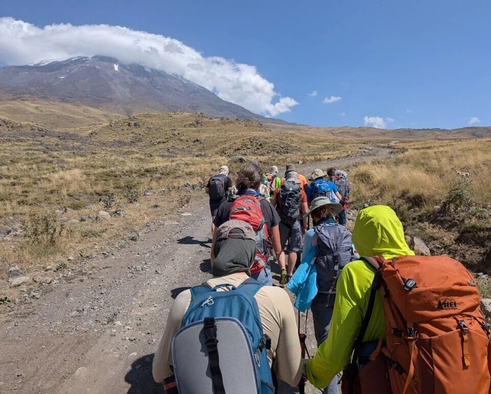
We loaded into minivans around 9:30am and drove about an hour to the mountain, plus another 15 minutes at a military checkpoint for permit verification. Packed lunches were provided each day — juice, local sweets, a sandwich. There was enough proper food at the camps that I left most of mine untouched.
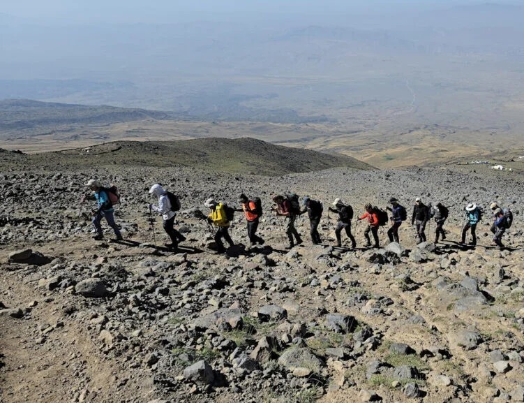
The minibuses dropped us at around 2,200m and we trekked 7km to Camp 1 at 3,300m, taking roughly 4.5 hours at a relaxed pace. Part of the route follows an unpaved road — dusty when the occasional car passes — before cutting onto a dedicated trail shared only with the horses carrying our duffle bags up to Camp 2. That section is considerably more pleasant.
Sun protection is essential. It's hot and exposed on the lower slopes.
Camp 1 was more comfortable than expected: a dedicated kitchen-and-gathering tent, permanent framed sleeping tents with elevated beds, a hot shower, and a toilet with running water. There was even LTE signal. The one gap: no charging facilities. We were the only group there, so we had the whole camp to ourselves. Tea and snacks were waiting on arrival. Dinner was at 6:30pm.
I'm a committed believer in the "hike high, sleep low" acclimatisation method, so I took the opportunity to push up another 300–400m before dinner while others rested.
Breakfast at 7am, then up the same trail we'd take the following day to reach Camp 2. The guides estimated 3–4 hours; we did it in 2.5 (3.3km, 750m elevation gain), with the group moving well. The trail starts relatively flat and steepens considerably as you near Camp 2 — a good gauge of how everyone is handling altitude on technical terrain.
We spent just under two hours at Camp 2 for acclimatisation — tea, photos, rest — then descended the same route. The afternoon was free. I'd have preferred a slightly different route for the acclimatisation day to keep things fresh, but the logic of rehearsing the terrain is sound.
Full pack day. Duffle bags loaded onto horses before breakfast, then a slower hike up than Day 3. One group member had been struggling with altitude sickness for two nights and made the sensible call to stay at Camp 1 and wait for our return.
At Camp 2 we settled into two large framed tents, eight per tent. Those without their own crampons had them issued here. There's no snow or ice near Camp 2, which meant no chance to practice crampon technique in real conditions — a missed opportunity. Poor crampon use on technical terrain is a risk to yourself and everyone around you, and I'd have liked to see the guides dedicate some time to basics before the summit push.
Early dinner around 5pm, then to bed. Wake-up call: 12:30am.
Sleep was difficult — adrenaline, altitude, and the considerable snoring situation in an eight-person tent. At "breakfast" one more member decided not to continue: he wasn't feeling right. This turned out to be a serious case of HAPE requiring evacuation — I've written about it in detail in a separate article.
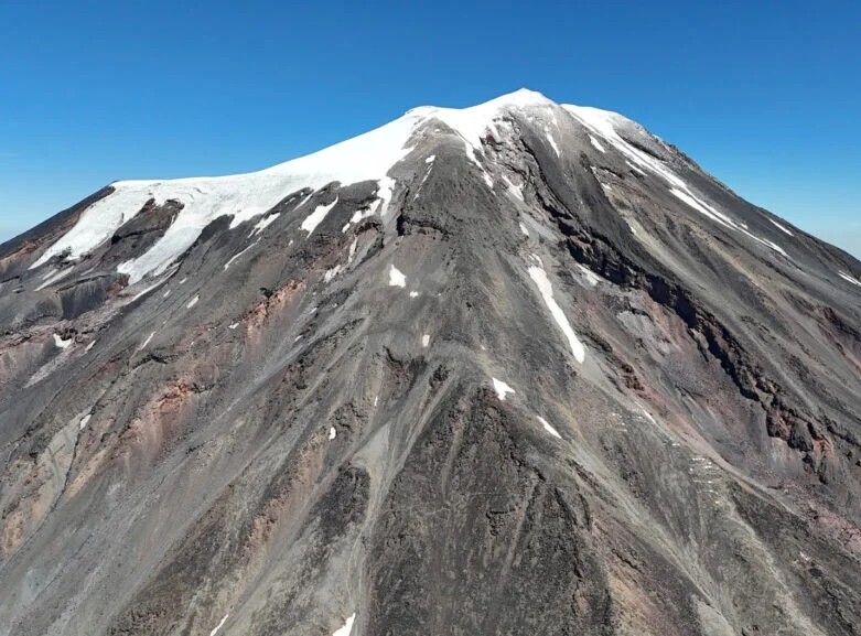
We set off at 1:30am at a deliberately slow, steady pace. The trail was straightforward, with only a few moderately steep sections. I'd overdressed slightly, which is the right mistake to make — as we neared 5,000m it was around -4°C with stronger-than-forecast winds. Ski mask, balaclava, and warm mittens all earned their place in the pack. Single-layer mountaineering boots held up well; even those in lighter footwear had no issues.
At the glacier we stopped to put on crampons — a windy, exposed spot not ideal for the task. We used them both up and down, though some other groups on the mountain only used them on the descent.
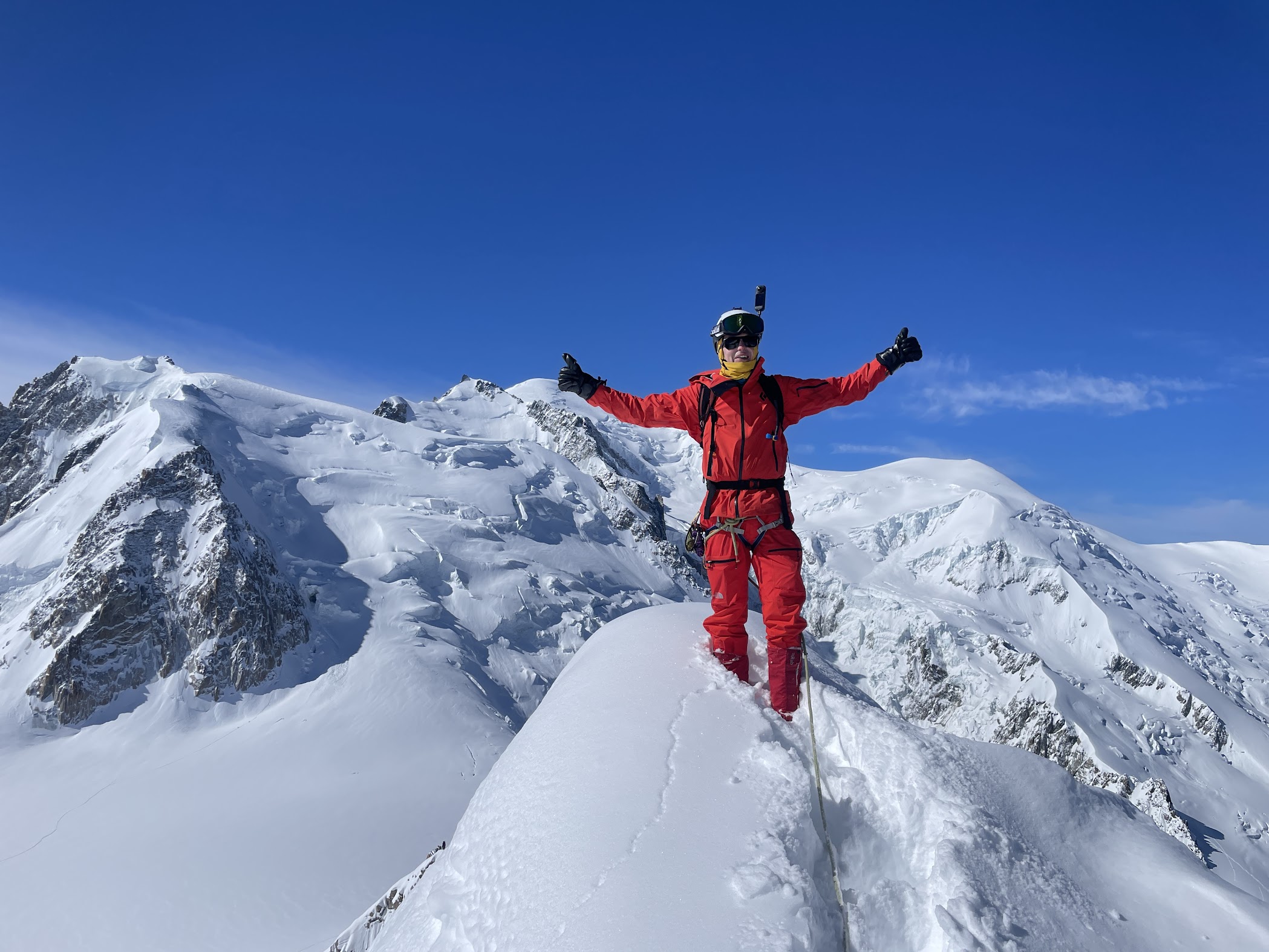
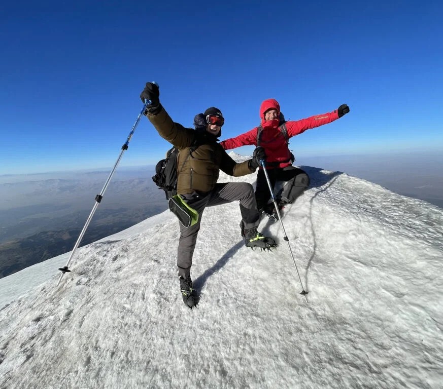
The summit was ferociously windy. Holding your poles and keeping your pack on required actual effort. We couldn't hear each other speak. No drone footage, no extended celebration — a few photos and we moved.
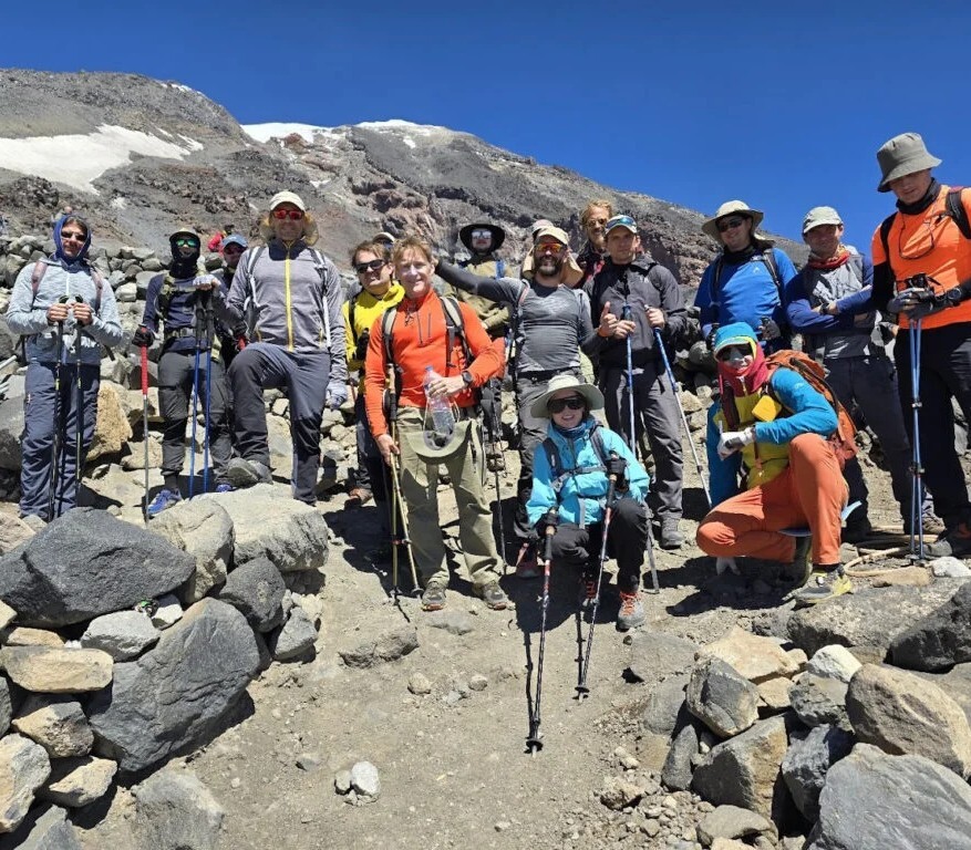
All 15 who left Camp 2 made it to the summit, without needing to split into faster and slower groups. Everyone who signed up trained for this — and it showed.
Back at Camp 2 by 10am. The HAPE evacuation had disrupted the guides' availability, so we descended to Camp 1 in small independent groups. I was at Camp 1 by 1pm; the rest arrived within the hour. Early dinner, early sleep.
Stats: Start 1:30am · 7.6km roundtrip · ~8.5 hours total · ~5 hours to summit · 1,250m ascent by GPS
We started early to beat the midday heat. Clear skies, good light, plenty of photo opportunities on the way down. We covered 7km and 1,200m of descent in 2.5 hours and were back at the hotel in Doğubayazıt by 11:30am.
After lunch we drove to Ishak Pasha Palace — one of the finest preserved examples of Ottoman-era palatial architecture in the region, and one of the best-preserved palaces of its kind anywhere in Turkey.
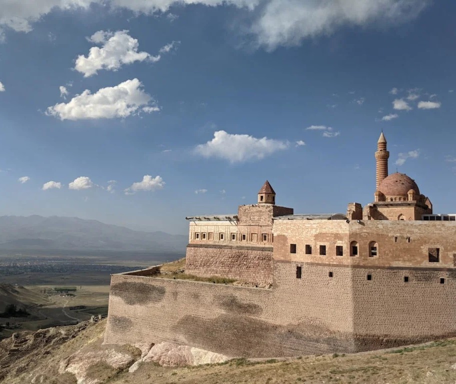
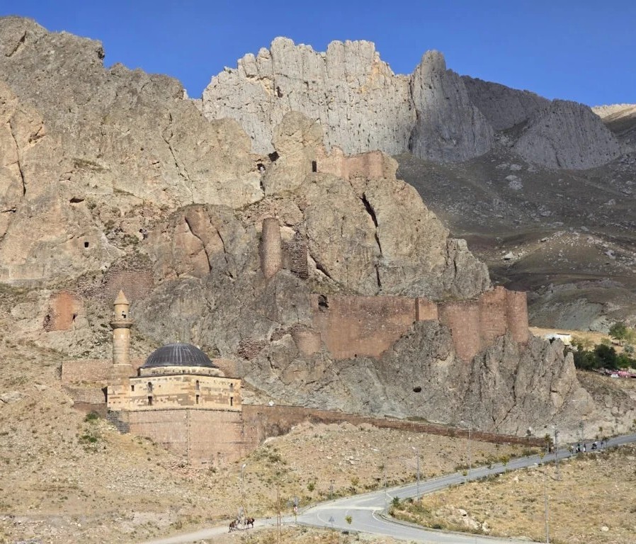
The palace walls are largely intact, though the interior is sparse — most original artifacts are long gone. An hour to ninety minutes is enough to see it properly. From the plaza, you can spot the ruins of an ancient Urartian castle on the ridge above, estimated at nearly 3,000 years old. It looked entirely undeveloped and completely compelling. We didn't have time. It goes on the list.
Back to the hotel, then a short walk to a local hamam. Not a tourist bathhouse — this was in a local apartment building, the kind of place residents actually use. They had swim trunks for rent, which was fortunate for the mountaineers who hadn't thought to pack any. We had access to a pool, dry and wet sauna, and a soap massage, which is exactly as different from an oil massage as it sounds. A good way to close out a few days on the mountain.
The day ended with dinner, more kebabs, and the first round of goodbyes — several people had very early departures the next morning.
Most of us flew from Iğdır to Istanbul. Just before departure, a delay notification arrived — which I assumed would mean a relaxed lunch at the airport. That was optimistic. Iğdır airport is small, remote, and offers essentially nothing in the way of food beyond a basic snack bar. A sandwich, if you're lucky. With the extra time, stopping somewhere in town for a proper meal would have been the smarter call.
Istanbul added one more small adventure: Uber directions that navigated us outside the airport perimeter — about 15 minutes on foot — rather than to any accessible pickup point. The cabs right outside the exit door would have been faster and simpler. Worth knowing for next time.
Ararat is accessible without being easy. The logistics are manageable, the terrain is non-technical on the standard route, and the mountain is genuinely spectacular. What it demands is fitness, proper preparation, and respect for altitude — as our HAPE case made clear, the mountain will find the gaps in your readiness.
The emergency aside, this was one of the better trips we've run: a strong group, a real summit, and the kind of experience that's hard to replicate anywhere closer to home. For anyone considering a first 5,000m peak, or looking for a team expedition with genuine challenge — Ararat is worth serious consideration.
This expedition was organised as part of the Geeks Go Peaks project. If you're interested in joining a future trip, we'd love to have you.
We send something when there's something to send. Upcoming climbs, open spots, and the odd story worth your time.
After Percona Live Bay Area 2026, twelve of us had a weekend and a plan: Yosemite. Four days, 16 km of trail, seven climbing routes at Camp 4, and one very strange hotel room assignment. The park held up its end.
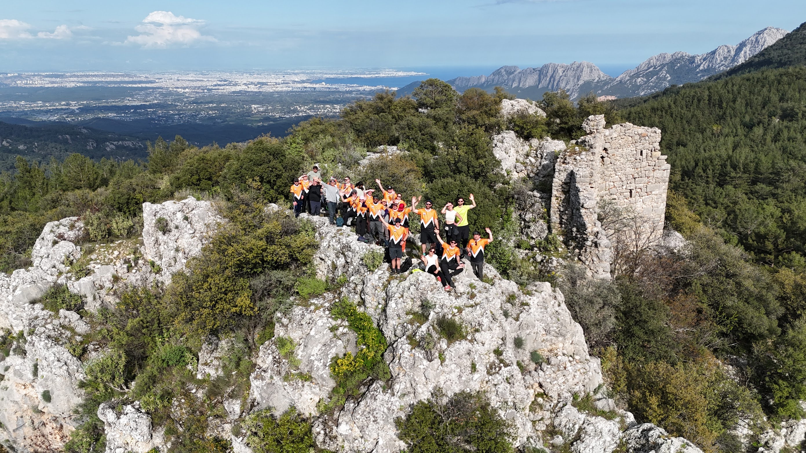
We took Percona's engineering team climbing in Geyikbayiri — sport routes in the Taurus mountains, a trek to Roman ruins, a handmade banner, and a motto that ended up on a jersey.
A weekend scouting trip to the Chamonix area turned into a three-day adventure — right as a freak storm dumped 1.5 meters of fresh snow above 2,000 meters. Though the plans changed, mountains did not disappoint anyway.